Commercial Aerial Imaging & Data for Properties, Facilities & Project Teams

Altravar provides professional aerial photography, site documentation, drone mapping, and geospatial data for commercial properties, industrial facilities, redevelopment projects, infrastructure, and professional project teams

Milwaukee-based • Serving Southeastern Wisconsin and statewide projects 

AERIAL SERVICES

Aerial Imaging Matched to the Project

Not every project requires the same type of aerial deliverable. Altravar provides straightforward commercial imagery, repeatable site documentation, and measurable mapping products based on what the project actually requires.

02
Document Sites & Properties
Create a detailed visual record of buildings, facilities, infrastructure, pavement, rooftops, and surrounding site conditions for documentation, inspection, maintenance, reporting, and historical reference.
03
Track Change Over Time
Use repeatable aerial captures to document construction, redevelopment, property changes, and project milestones from baseline conditions through subsequent phases.
04
Create Measurable Site Maps
Produce high-resolution orthomosaics that document large properties in a single coordinated view and support distance, area, and location measurements.
05
Understand Terrain & Elevation
Derive elevation models, contours, slope, and terrain visualizations to reveal topography, grading conditions, drainage patterns, and elevation changes not apparent in conventional aerial photography.
06
Share & Integrate Site Data
Deliver interactive maps, GIS-compatible data, processed imagery, or organized source data for use by owners, consultants, contractors, and professional project teams.

COMMERCIAL AERIAL IMAGING

Properties, Facilities & Sites in Context

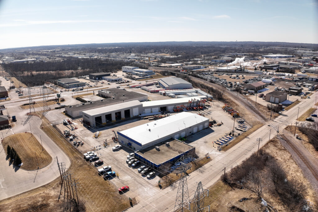
High-resolution aerial imagery documents commercial properties, industrial facilities, land, redevelopment sites, and their surrounding context. Imagery can support marketing, property documentation, planning, stakeholder communication, and other project-specific needs.

SITE & PROGRESS DOCUMENTATION

Snapshots In Time

Consistent aerial captures provide objective snapshots of a site at different points in time. Using a repeatable flight and processing workflow makes it easy to review changing site conditions, document completed work, and maintain a visual record of a project as it evolves.  Woodsonia Redevelopment Project – approx. 26 acres – Brown Deer, WI

Baseline drone mapping orthomosaic of the Woodsonia redevelopment project in Brown Deer, Wisconsin

DRONE MAPPING & GEOSPATIAL DATA

From Aerial Imagery to Measurable Site Information

Photogrammetric processing transforms aerial imagery into coordinated site information that can be measured, analyzed, shared, and revisited. Depending on project requirements, deliverables can include orthomosaics, terrain and elevation products, contours, GIS-compatible data, and interactive maps.

INTERACTIVE PROPERTY MAP

Explore An Entire Commercial Property In One Interactive Map

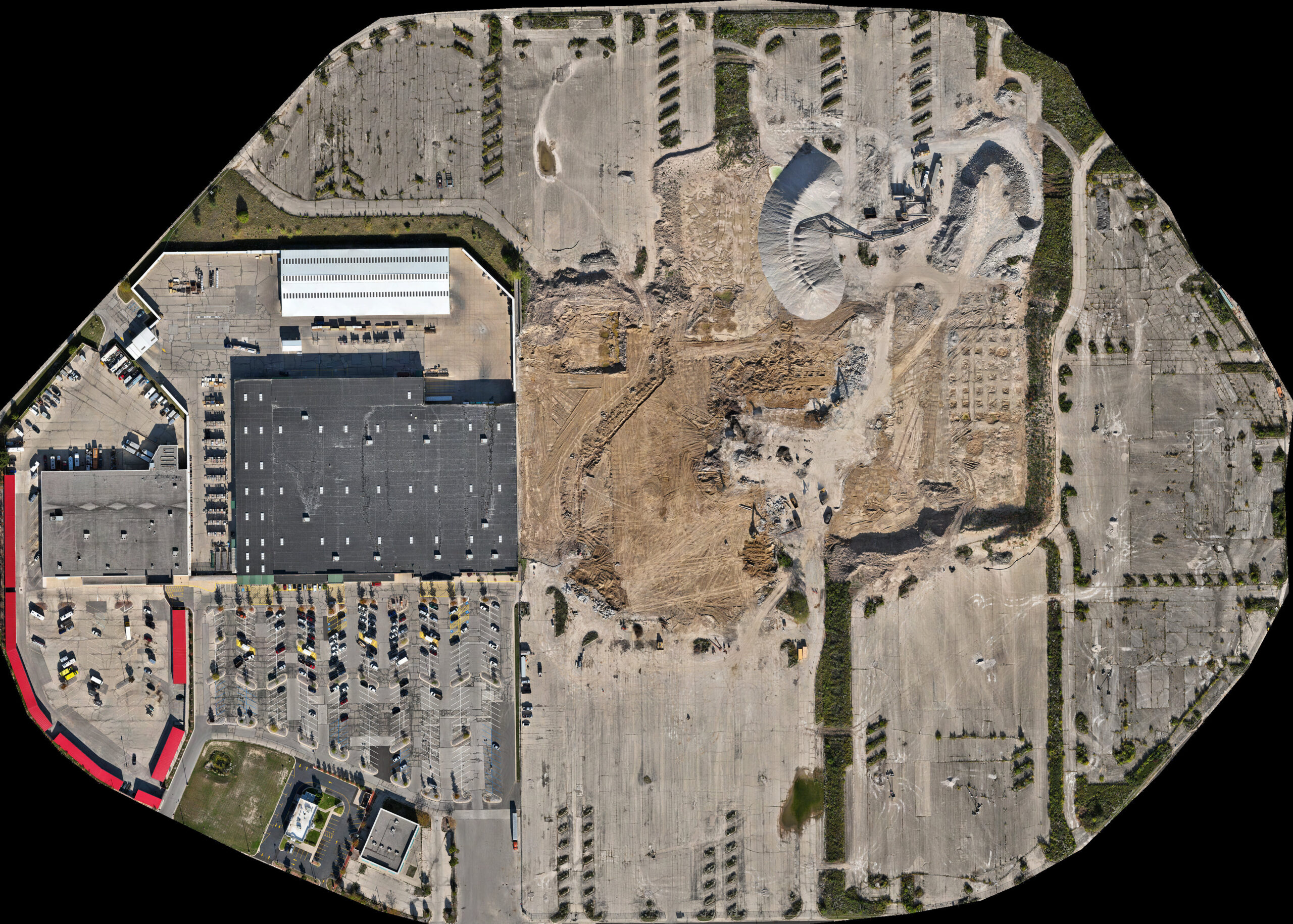
Large commercial and redevelopment properties can be documented as a single, high-resolution orthomosaic that supports measurement, analysis, and long-term documentation. Explore this interactive 85-acre property map to examine site conditions from a single coordinated aerial survey. Northridge Circle Redevelopment Project – approx. 85 acres – Milwaukee, WI

85-acre drone mapping orthomosaic of the Northridge Circle site in Milwaukee, Wisconsin

ONE SURVEY • MULTIPLE DELIVERABLES

One Survey - Multiple Perspectives

A single aerial survey can produce multiple forms of geospatial information. Orthomosaics, terrain visualizations, contours, and elevation products are generated from the same dataset, providing different perspectives on the same property without additional field collection. Landfill Operation – approx. 120 acres – Germantown, WI

Select each view below to see how the same aerial survey reveals different aspects of the same property.

Color-relief elevation visualization derived from drone mapping of a landfill in Germantown, Wisconsin

Color-relief visualization highlighting elevation differences across a landfill.

UAS FIELD ACQUISITION

Wisconsin UAS & Drone Data Acquisition for Project Teams

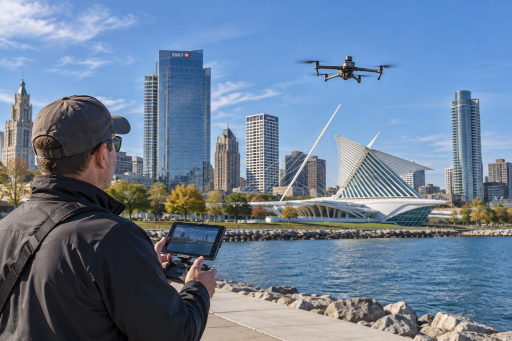
Drone field operation near the Milwaukee Art Museum

Altravar provides local UAS field acquisition for engineering, environmental, architectural, surveying, and other professional project teams. When internal UAS resources are committed elsewhere, or when deploying a client’s staff and equipment to southeastern Wisconsin is inefficient, aerial data can be collected to client-defined project requirements and delivered for use within existing photogrammetry, GIS, engineering, inspection, or documentation workflows.

01

Client-Specified Acquisition

Work from client-defined areas of interest, flight plans, capture specifications, control requirements, and established project protocols. Consistent acquisition methods can also support repeat assignments, existing-condition documentation, and change analysis.

02

RTK-Capable Collection & Source Data

DJI Mavic 3 Enterprise with RTK capability supports accurate, consistent, and repeatable aerial data collection. Organized source imagery can be delivered for use within existing photogrammetry, GIS, engineering, inspection, or documentation workflows.

03

Local & Controlled-Airspace Operations

Local field acquisition is available throughout southeastern Wisconsin, including controlled-airspace assignments requiring FAA project-specific authorization when operating requirements exceed available automatic-approval limits. Acquisition can be provided independently or paired with orthomosaics, elevation products, interactive mapping, and other processed deliverables when appropriate.

Professional-services boundary: Where licensed professional services are involved, Altravar’s role can remain limited to aerial data collection performed to the project team’s requirements.

DISCUSS YOUR PROJECT

Let’s Discuss Your Project

Every project begins with understanding what needs to be captured, documented, measured, or communicated. Whether you need commercial aerial imagery, repeatable site documentation, measurable mapping, or aerial data collected to an established specification, Altravar can tailor the acquisition and deliverables to the project.

Based in the Milwaukee area, Altravar serves commercial properties, industrial facilities, land, redevelopment projects, and professional project teams throughout southeastern Wisconsin, with availability for suitable projects statewide.

Contact Form

FAA Part 107 Certified • Insured Commercial Operations • RTK-Capable Acquisition • Controlled-Airspace Authorization Experience

Scroll to Top